
North Carolina Department of Transportation said Thursday that it was preparing for another winter storm in the area and urged residents to prepare as well.
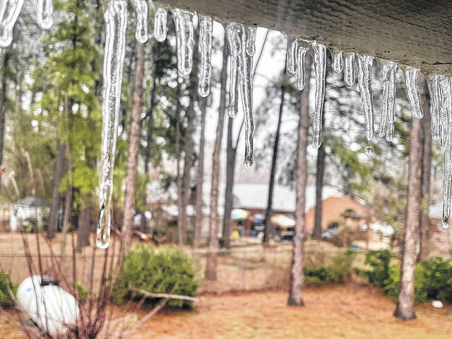
Freezing rain throughout the region caused power outages over the weekend. Now, forecasters are calling for snow to fall beginning Thursday night.
The National Weather Service issued a Winter Weather Advisory on Thursday urging residents to prepare for snow, freezing rain and very low temperatures during the next few days in the greater Robeson County area.
“Periods of freezing rain early Friday will mix with sleet and snow late Friday afternoon and likely become all snow during Friday night,” forecasters stated in the advisory. “Total ice accumulations will range between 0.05 to 0.20 inches. Total combined sleet and snow accumulations will run less than 1 inch.”
The advisory state the ares that will be impacted include portions of northeast South Carolina and southeast North Carolina, including Robeson, Marlboro, Darlington, Dillon, Florence and Marion counties, as well as Lumberton, Bennettsville, McColl, Hartsville, Darlington, North Hartsville, Dillon, Florence,Marion and Mullins.
Robeson County largely escaped the weekend’s forecasted weather, with only a handful of reported power outages, but Mother Nature will be back on Friday, this time threatening to bring snow to the region.
National Weather Service forecasters reported Monday that snow is possible as early as 11 p.m. Thursday as temperatures are expected to drop to around 26 degrees.
The chance of precipitation is 30%, according to a weather statement released on Monday. Friday is expected to bring a 30% chance of snow before 1 a.m., but have not provided an accumulation outlook. Forecasters are calling for mostly cloudy skies with a low around 23 degrees.
Any snow that arrives late in the week will likely be short-lived as Saturday temperatures are expected to rise to around 38 degrees and 42 degrees on Sunday.
Observed Weather
According to NWS data, the region has seen 3.41 inches of rain so far in January, that’s substantially higher than the normal 1.79 inches, although last year, the region saw 3.33 inches of rain for the month so far.
The record low temprature for today was set in 1977 when residents stepped outside to a very chilly 8 degrees, which was actually two degrees warmer than the 6 degrees recorded the day before, a record low for that day as well.
The 10 coldest record-setting January days took place on the following dates:
— Jan. 2, 1985, -1 degrees;
— Jan. 4, 1918, 4 degrees;
— Jan. 11, 1982, 7 degrees;
— Jan. 11, 1974, 7 degrees;
— Jan. 13, 1981, 7 degrees;
— Jan. 17, 1977, 6 degrees;
— Jan. 19, 1994, 7 degrees;
— Jan. 20, 1994, 7 degrees;
— Jan. 21, 1985, -1 degrees;
— Jan. 18, 1977, 8 degrees;
On today’s date in 1943, the record high was recorded at 80 degrees, one of nine days in January that set records with temperatures in the 80s.
Residents may remember a balmy New Year’s day just a couple of weeks ago. The National Weather Serivce recorded a record 81 degrees on that day.
January’s record setting 80-plus degree days were:
— Jan. 1, 2022, 81 degrees;
— Jan. 3, 1952, 81 degrees;
— Jan. 7, 1946, 80 degrees;
— Jan. 13, 2017, 80 degrees;
— Jan. 15, 1932, 80 degrees;
— Jan. 17, 1943, 80 degrees;
— Jan. 18, 1937, 80 degrees;
— Jan. 27, 1950, 81 degrees;
— Jan. 28, 1952, 80 degrees.
Power outages
The freezing rain that visited the region on the weekend left some areas without power as late as Monday afternoon.
By midday on Sunday, Duke Energy reported 27,000 customers had lost power in North Carolina and 40,000 South Carolina customers had lost power.
“So far, North Carolina’s hardest hit counties, in terms of power outages, include: Gaston, Jackson, Macon and Swain,” according to a report released Sunday.
“I thank our customers, in advance, for their patience and understanding during what could be a multi-day power-restoration process, given the expected widespread damage to our electric distribution system across both states,” said Jason Hollifield, Duke Energy Carolinas storm director.
As the wet and freezing conditions began to move toward the Carolinas, Duke Energy staged more than 11,000 workers – power line technicians, damage assessors and vegetation workers – across the region.
According to information from Duke Energy on Sunday, those workers included Duke Energy crews normally based in Florida, Indiana and Ohio – and mutual assistance crews from other companies in Canada, Texas, Arizona, Wisconsin, Louisiana, Oklahoma and other states – who traveled to the Carolinas to assist efforts here.
Buildup of ice on tree branches that caused them to fall onto power lines was the main cause of power outages during the winter storm.
“Specifically, ice buildup of a quarter-inch or more is often the threshold amount that causes trees and branches to topple,” according to Duke Energy officials. “The heavy weight of significant ice buildup directly on power lines themselves can sometimes cause the lines to fall or sag, as well. Heavy, wet snow of six inches or more also can cause trees and branches to fall on power lines.”
Residents experiencing outages can text the word “OUT” to 57801 to report an outage.
David Kennard is the executive editor of The Robesonian. Contact him at [email protected].


